Political Mapping
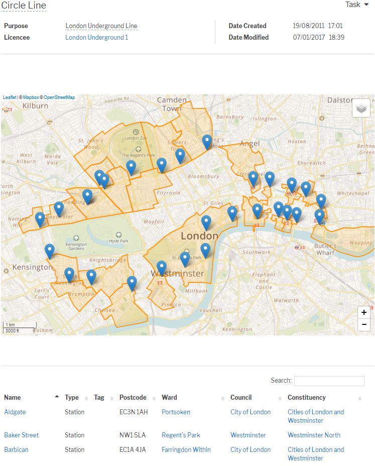
Mapolitical has the capability for users to plot in their own infrastructure onto a UK map, save their work and view it again at a later date and produce political mapping reports.
Our research team updates the political /governmental contacts for elections and other changes keeping the report results fresh.
Geographic data reports can be produced from any infrastructure entered into the system.